Let’s head back to the lake one more time. When I last posted, I left you on the shore at Mary Alice Park, with a Harley rider gazing across Lake Lanier. I left the park ahead of him, but he passed me a short bit later as I’d stopped by the side of the road for another picture.
All around Lake Lanier people with lakefront property have built floating docks, some of them with large boathouses on them. These are some of the smaller variety.
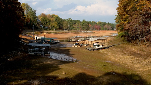
As you can probably realize, they’re used to having a a lot more water underneath those docks — probably about 14-15 feet in this little cove.
 My next stop was West Bank Park, right next to the dam itself. There’s a nice little beach there, amongst the picnic areas and walking trails. The beach is usually about 100 feet of sand, then about as much room until the swimmers reach a set of depth markers and a rope with floating orange markers marking the point beyond which they shouldn’t go.
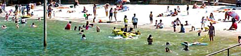
I was able to find a picture of the beach in better years on a US Army Corps of Engineers park schedule site; near the left side you can see one of the wooden posts that has the depth marking signs on it. The rope and orange markers are off the bottom of the frame.
Here’s a view of the beach as it exists today, taken from the cove to the east.
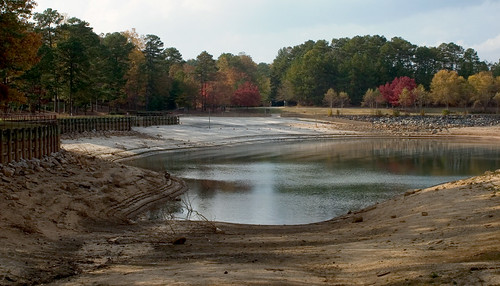
If you look closely you can see the orange markers, on their rope, laying on the ground about halfway to the water’s edge. Here’s a closer look, this time from the beach.
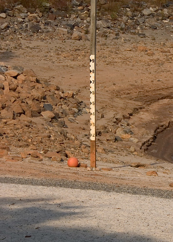
I walked down to the edge of the water and when I looked back, the orange markers — laying on the ground like ripe pumpkins — were all above my head.
Nobody was swimming.
The drought also has its ups. I have been finding interesting and antique bottles on the ever expanding shores of Lake Lanier